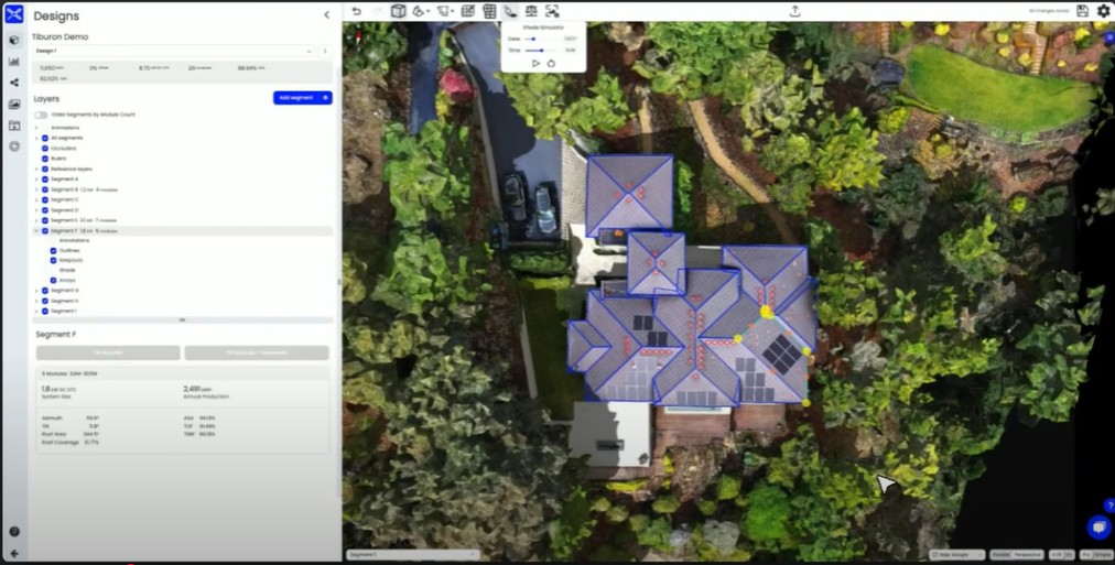
Scanifly and EcoFasten demo Solar PV design and field operations software company Scanifly, best known for its drone service, is now integra...
Scanifly uses real-time, onsite drone data that is automatically scaled to produce a 3D scene and digitally simulate bankable shade values. ...
Scanifly announced integrations with Nearmap, LiDAR and other remote data sources as part of its new preliminary design solution, Scanifly P...
The coverage of aerial imagery has increased in the last decade, which was a boon for solar contractors trying to quickly sell a project. Ho...
Both New York State Energy Research and Development Authority (NYSERDA) and the Massachusetts Clean Energy Center (MassCEC) have approved sh...